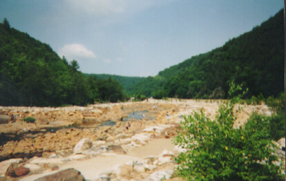
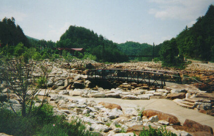
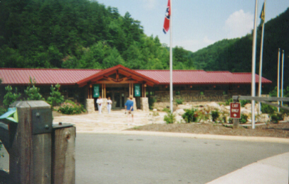
Blue Hole Ocoee

Directions to Blue Hole From Atlanta

Revised 19 July 2022

There are two routes to get to Blue Hole from Atlanta. The more "scenic" route takes you up I-75 to Hwy 411 and then along Parksville Lake, TVA's big Ocoee #1 dam and the Ocoee River Gorge itself. It is also significantly longer and has more two-lane roads as opposed to highways. I've moved those directions to this separate file for brevity. The second route, described below, is a lot quicker since it involves more freeway-speed driving, but it's not as scenic and oddly enough, involves more turns.

The Faster Route to Blue Hole from Atlanta

  1. Take I-75 North out of Atlanta.
  2. Take the ramp for I-575 and keep going north. This is yer basic freeway with two lanes in either direction, and controlled-access exits.
  3. Stay on I-575. I-575 ends and the road becomes a four-lane divided highway (not controlled access), with the occasional traffic light and intersection. Keep going.
  4. You're now on GA Hwy 5 (among others) heading north. Put a CD in and set the cruise-control for 65. It'll be about an hour. (I recommend Green Carnation's Light of Day, Day of Darkness, which runs an hour and six seconds...and it's one long song, a progressive-metal masterpiece. :)) You'll cruise through Jasper, and then East Ellijay. You can start paying attention again as you pass through the tiny hamlet of Cherry Log.
  5. The next town is Blue Ridge. At Blue Ridge you'll come to a traffic light with a McDonalds on the opposite left corner and the signs will indicate Hwy 5 makes a left turn here. Follow the sign and make a left.
  6. You're now on Hwy 5 between Blue Ridge and McCaysville, GA. This is a well-laid two-lane road with an occasional passing lane on uphills. It's about 10 miles to McCaysville. As you approach the town the road will go downhill to a river. Cross the river on the bridge. At the stop sign, where the road dead-ends, take a left. This intersection is actually located in Georgia and Tennessee, which explains why no-one's put up a traffic light yet. (!) You can see a blue dotted line on the ground which marks the state border, along with signs. As you turn left, you cross into Copper Hill, Tennessee. As a warning, the speed limit here is 20 mph. It gradually increases, but be extremely cautious with this since I've gotten a ticket here: just because the road becomes a four-lane doesn't mean the speed limit is 55mph...yet!
  7. You'll go through two lights and cross some railroad tracks, passing a small railyard on the left and a smelting plant on the right. After a while the road will open up into a four-lane divided highway. Don't exceed 45mph until a sign says you can do so. After you go under a railway bridge keep to the right and watch for a junction sign for US 64. The ramp will come up suddenly on the right. Take this ramp.
  8. At the foot of the ramp take a left. You are now on US Hwy 64. This intersection is located in Ducktown, TN.
  9. This part of US 64 is a wide two-lane road with some good hills. You'll go about 7 miles on it, entering the Cherokee National Forest. As you come down a hill you may see a brown sign for the Ocoee Whitewater Center, although they should remove it since the building is gone. Ahead of you it looks like the road gets narrower. Slow down.
  10. The upper parking lot by the ruins is closed; do NOT get in the turning lane. Continue down the hill past the ruins. You'll see the day-use parking lot on your right. A bit further you'll see the lower entrance on your left. Turn left here and drive back up the hill through the parking lot.
  11. You'll pass the only remaining restrooms on the left (basically permanent porta-potties). You can park anywhere in this "fee area," but parking toward the top of the hill would be a shorter walk to the actual Blue Hole swimming hole. Go to one of the Daily Use fee kiosks and drop the $3 envelope in the slot, and put the stub on your dashboard. You're all set! Or, you can be like me and get an annual pass, online, at Recreation.Gov. :) A pass for the entire Cherokee National Forest is now $30 for 12 full months from the date of issue. That's a great deal, since it also includes places like Mac Point Beach, Parksville Beach, the Chilhowee Recreation Area, and all the other Daily Use Fee Areas in the Forest including boat ramps and shooting ranges. Note that it does not include overnight camping in developed campgrounds, which runs typically $12-30 per night.
    Taken from the parking lot facing downriver Facing upriver: OWC was the red building in the distance at left OWC itself, taken from the short-term parking lot. R.I.P.
------------ blue separator ------------------

1998 Roadtrip Diary | 1999 Roadtrip Diary | 2000 Roadtrip Diary | 2001 Roadtrip Diary | 2002 Roadtrip Diary |
2003 Roadtrip Diary | 2004 Roadtrip Diary | 2005 Roadtrip Diary | 2006 Roadtrip Diary | 2007 Roadtrip Diary |
2008 Roadtrip Diary | 2009 Roadtrip Diary | 2010 Roadtrip Diary | 2011 Roadtrip Diary | 2012 Roadtrip Diary | 2013 Roadtrip Diary | 2014 Roadtrip Diary | 2015 Roadtrip Diary |
Current Summer Roadtrip Info |

Top of Paul's home page
Books I'm reading now
My current fave musical vibes
All of my CDs
Music links
Personal info
Ways to contact me or chat online